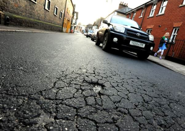
Medieval ditch theory for sinking Midhurst road is ruled out
This article contains affiliate links. We may earn a small commission on items purchased through this article, but that does not affect our editorial judgement.


Midhurst historian Bridget Howard has discounted the latest theory which comes from county councillor Gordon McAra that the road is sinking into a medieval ditch.
“He is right that an archaeological survey discovered a medieval ditch, but it doesn’t go anywhere near Rumbolds Hill,” she said.
Advertisement
Hide AdAdvertisement
Hide AdIt was probably a defence against the Vikings, she said, but the survey map showed it ran from the south side of St Ann’s Hill, along the back of Edinburgh Square, across South Street to the Jacobean Hall at The Spread Eagle turning at a right angle between Wool and Duck Lanes: “Then it went north coming to what is now Knockhundred Row, turned and went back to St Ann’s Hill - three sides of a square.”
Bridget added: “I believe the tunnel theory for the sinking road is folk memory of this ancient ditch.”
Meanwhile West Sussex County Council says it is still monitoring the state of the road.
Don’t miss out on all the latest breaking news where you live.
Advertisement
Hide AdAdvertisement
Hide AdHere are four ways you can be sure you’ll be amongst the first to know what’s going on.
1) Make our website your homepage at www.midhurstandpetworth.co.uk/
2) Like our Facebook page at www.facebook.com/MidhurstandPetworthObserver
3) Follow us on Twitter @mid_pet_obs
4) Register with us by clicking on ‘sign in’ (top right corner). You can then receive our daily newsletter AND add your point of view to stories that you read here.
And do share with your family and friends - so they don’t miss out!
The Midhurst and Petworth Observer - always the first with your local news.
Be part of it.