Sussex and Surrey weather warning: Flooding 'possible' amid heavy rainfall; will there be snow?
and live on Freeview channel 276
According to the Met Office, periods of heavy rain will ‘bring the possibility of some disruption’ – particularly to transport.
The yellow warning came into force at 2am today (Thursday, February 8) and is set to remain in place until 6am tomorrow (Friday).
Advertisement
Hide AdAdvertisement
Hide AdDetailing what people can expect in the affected areas in the South East, a Met Office spokesperson said: “Flooding of a few homes and businesses is possible
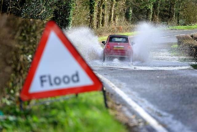

"Bus and train services probably affected with journey times taking longer. Spray and flooding on roads probably making journey times longer.
"A couple of bands of rain, heavy in places, will push northwards across southern England and south Wales during Thursday and early on Friday.
"Whilst a drier interlude is likely for a time during the middle part of Thursday, many places in the warning area will see 15-25 mm of rain accumulate during this period.
Advertisement
Hide AdAdvertisement
Hide Ad"However, some higher ground areas of southern England and south Wales could see as much as 35-45 mm of rain.”
Large parts of the UK are covered by snow and nice warnings. An amber warning is in place in South Yorkshire, West Yorkshire, Derbyshire and Staffordshire.
The most recent forecast by the Met Office has advised that snowfall is expected to occur around the Peak District and South Pennines later today at lunchtime, with an amber weather warning in effect for this area until 6pm today.
Snow and ice are expected to cause disruption across north Wales and northwest Shropshire also from 8am today until 3pm, which is also under an amber weather warning alert.
Advertisement
Hide AdAdvertisement
Hide AdIn parts of Scotland, snowfall is expected from 6pm this evening until 3pm tomorrow, while a large portion of the North East and North of England might be waking up to flurries, which are expected to continue until 6am tomorrow morning.
Although these warnings do not affect the south, residents here are reminded of how to keep safe during heavy rainfall.
A Met Office spokesperson said: “Check if your property could be at risk of flooding. If so, consider preparing a flood plan and an emergency flood kit.
"Give yourself the best chance of avoiding delays by checking road conditions if driving, or bus and train timetables, amending your travel plans if necessary.
Advertisement
Hide AdAdvertisement
Hide Ad"People cope better with power cuts when they have prepared for them in advance. It’s easy to do; consider gathering torches and batteries, a mobile phone power pack and other essential items.
"Be prepared for weather warnings to change quickly: when a weather warning is issued, the Met Office recommends staying up to date with the weather forecast in your area.”
Comment Guidelines
National World encourages reader discussion on our stories. User feedback, insights and back-and-forth exchanges add a rich layer of context to reporting. Please review our Community Guidelines before commenting.